Amsterdam, during its golden age, was known for the size and scale of its creative industries, especially for paintings. At its peak, there were more than 300 painters working in the city, who accounted for the unprecedented painting production in various genres and styles.
However, where did the hundreds of painters live and work, and how did they move within Amsterdam overtime? Where and how did they sell their paintings in the city? How did specific locations contribute to the creation of arts and the development of a painter’s career? How did the preferences for certain locations vary among painters working in different styles, subjects, or operating in different market segments?
These are the questions centered in Weixuan Li’s dissertation research. The analytical challenge to answer these questions lies in integrating a large body of data from diverse sources in different formats and navigating through data to present in a nuanced way to facilitate observations.
This particular challenge leads to the second set of her research question, concerning the digital methodologies:
- How can big historical data and spatial analysis assist historical and art historical research in the early modern period?
- How can we operationalize the concept of deep mapping?
- How can one create a deep map accounting for and visualizing uncertainties in the historical sources?
Multilayered deep mapping
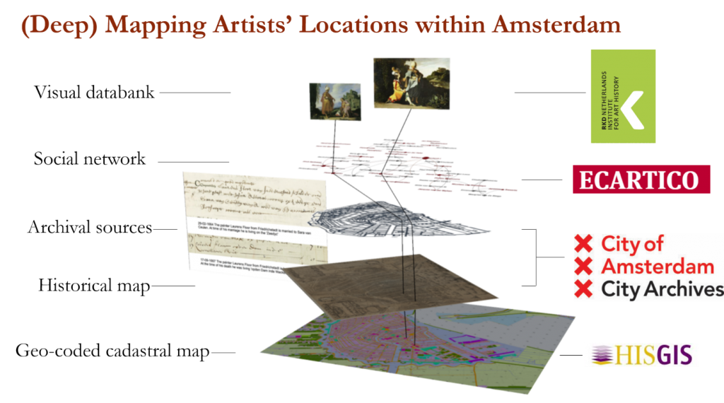
Deep mapping Golden Age Amsterdam takes advantage of the rich of data from sources and uses spatial analytical tools like Geographic Information System (GIS) to facilitate the analysis and visualization of the historical materials. The unmovable, objective geolocation of places and houses provides as an anchor to align the ever-changing historical events and people, which allow observations of the spatial distribution of painters and its changes across time. In particular, this spatial anchor of geolocation can be connected to the social network of painters to contextualize painters and their works within the social relations and urban space where they lived, worked, and socialized.
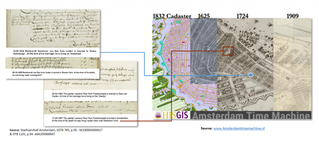
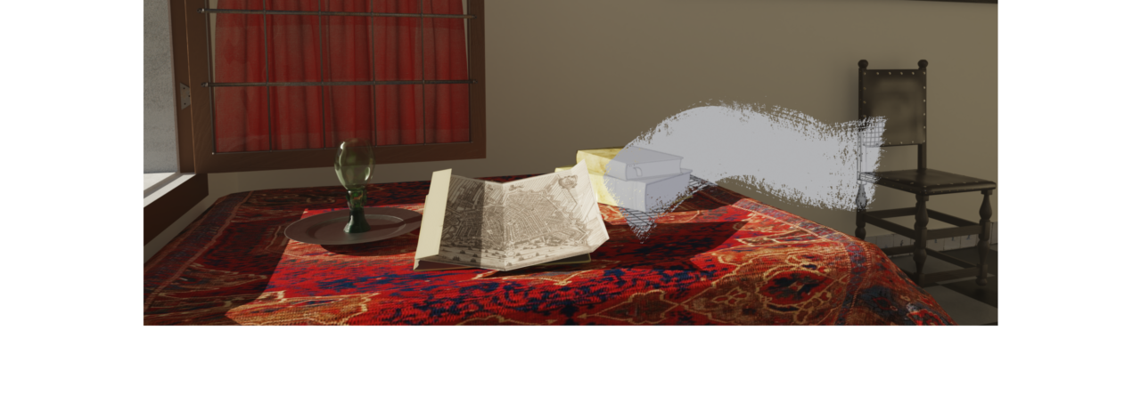
Methodologically, this research proposes a mechanism of translating the descriptions of location-related information in historical sources into concrete, georeferenced locations while accounting for the uncertainty and ambiguity in the historical materials. The physical, geo-coded locations, as vectorized in the first cadastral map of Amsterdam by the HisGIS project, serves as a basis in this geo-translation process and as an anchor for the alignment of historical maps, archival materials, and modern databases like ECARTICO and RKDimages. Based on the multi-layered map linking various historical sources, this research tries to bring the features of the urban space back to life through ‘deep mapping,’ and the artist and artworks will be studied in situ.
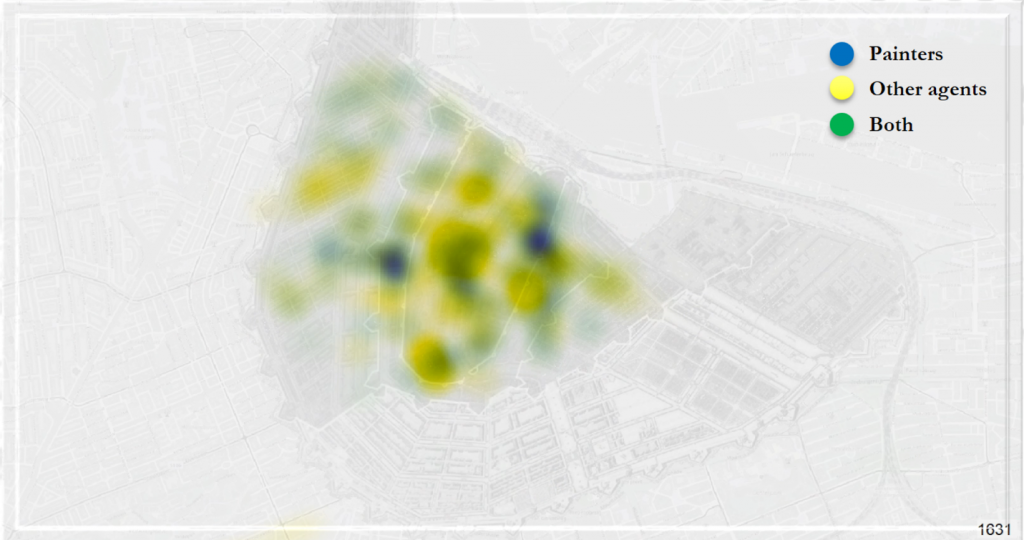
The multi-layered deep maps of Amsterdam will provide a scalable platform for research. Zooming out at the city level, it shows the spatial patterns of painters’ workshops within the urban context taking a broad-brush approach with a higher tolerance of uncertainties. Deep mapping creative industries in Amsterdam will embrace these uncertainties to see, experience, and understand space in all its complexity, and enable the visualization and analysis of migration pattern of the creative individuals within the city.
Researcher: Weixuan Li